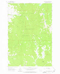
1962 Map of Stewart Mountain
USGS Topo · Published 1977About this map
The high backcountry of the Beaverhead National Forest defines this 1962 landscape, characterized by a complex network of pack trails and seasonal resource infrastructure. Human activity is centered around the Steel Creek Ranger Station and the adjacent Steel Creek Campground along the northern edge of the sheet. The area served as a focal point for small-scale extraction and forest management, evidenced by several scattered operations such as the Maynard Mine, Arnold Mine, and Martin Mine. A prominent Lookout Tower sits atop Odell Mountain, providing a strategic vantage point over the drainage basins of Steel Creek and Warm Springs Creek. The high-elevation terrain is broken by glacial features like Stewart Lake and Baldy Lake, while the transition into open grazing or gathering grounds is marked by Moose Meadows and Stewart Meadows.
Find a feature on this map
38 named features on this map. Tap any name to fly to it.
Don’t see what you’re looking for? This feature index may not catch every label — zoom into the map to look around manually.
Map Details
Editions of this 1962 Stewart Mountain Map
2 editions found
Other maps of this area

1955 · Dillon
USGS Topo · 1:250,000

1957 · Dillon
USGS Topo · 1:250,000

1958 · Dillon
USGS Topo · 1:250,000

1959 · Polaris
USGS Topo · 1:62,500

1962 · Dillon
USGS Topo · 1:250,000

1962 · Wisdom
USGS Topo · 1:24,000

1962 · Mud Lake
USGS Topo · 1:24,000

1962 · Stewart Mountain
USGS Topo · 1:24,000

1962 · Proposal Rock
USGS Topo · 1:24,000

1965 · Dillon
USGS Topo · 1:250,000