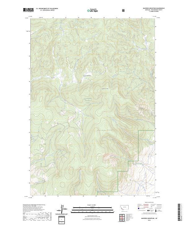
2024 Map of Maverick Mountain
USGS Topo · Published 2024About this map
The Pioneer Mountains dominate this high-altitude landscape within the Beaverhead National Forest. This modern study shows the complex watershed of the Big Hole Divide, where numerous drainage systems such as Wyman Creek and Old Tim Creek carve through the terrain. The presence of the Pyle Ditch in the southeastern corner near Grasshopper Valley reflects the region's managed water systems, while Maverick Mtn stands as a central topographic anchor. Transport is limited to primitive routes like Kinselman Creek Rd, emphasizing the wilder character of this portion of the forest. The map provides clear detail of the headwaters for several tributaries including Blue Creek and East Fork Pole Creek, which feed the larger drainage basins at the base of the mountain ranges.
Find a feature on this map
28 named features on this map. Tap any name to fly to it.
Don’t see what you’re looking for? This feature index may not catch every label — zoom into the map to look around manually.
Map Details
Editions of this 2024 Maverick Mountain Map
This is the sole edition of this map. No revisions or reprints were ever made.
Other maps of this area

1955 · Dillon
USGS Topo · 1:250,000

1957 · Dillon
USGS Topo · 1:250,000

1958 · Dillon
USGS Topo · 1:250,000

1959 · Polaris
USGS Topo · 1:62,500

1962 · Dillon
USGS Topo · 1:250,000

1962 · Stewart Mountain
USGS Topo · 1:24,000

1965 · Dillon
USGS Topo · 1:250,000
1978 · Odell Lake
USGS Topo · 1:24,000
1978 · Maurice Mountain
USGS Topo · 1:24,000

1978 · Butch Hill
USGS Topo · 1:24,000