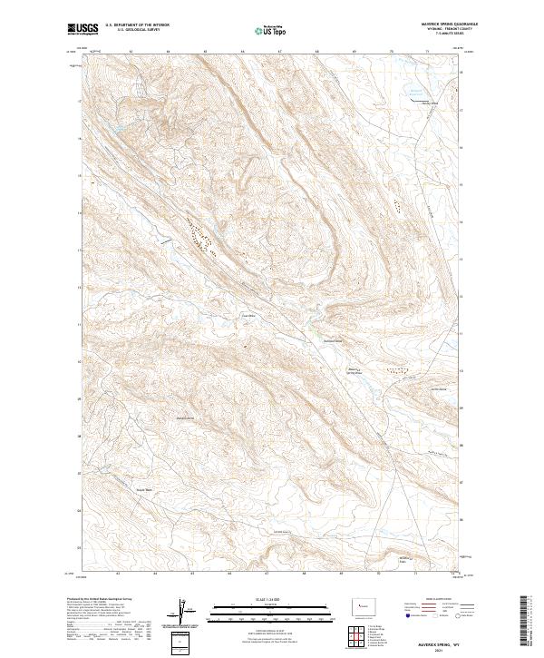
2021 Map of Maverick Spring
USGS Topo · Published 2021About this map
Maverick Spring lies at the heart of this high-plains landscape, where the topography is defined by the geological structures of Sheldon Dome and Little Dome. The area is characterized by a complex network of intermittent drainages, including Teapot Wash and Maverick Spring Draw, which carve through the arid terrain toward Fiv emile Cr. This 2021 survey illustrates the modern configuration of access roads such as Maverick Springs Rd and Circle Ridge Rd, which support the region's energy and ranching infrastructure. In the northeast, Barquin Reservoir provides a critical water source near Hurley Draw, while the expansive Wildhorse Flats stretch across the southern reaches. The map captures the specialized land use of Fremont County, where named draws like Coal Draw and Paintpot Draw reveal the distinct local nomenclature of the Wyoming basin.
Find a feature on this map
21 named features on this map. Tap any name to fly to it.
Don’t see what you’re looking for? This feature index may not catch every label — zoom into the map to look around manually.
Map Details
Editions of this 2021 Maverick Spring Map
This is the sole edition of this map. No revisions or reprints were ever made.
Other maps of this area

1904 · Kirwin
USGS Topo · 1:125,000

1906 · Kirwin
USGS Topo · 1:125,000

1951 · Lookout Butte SW
USGS Topo · 1:24,000

1951 · Eagle Point
USGS Topo · 1:24,000

1951 · Lookout Butte
USGS Topo · 1:24,000

1951 · Maverick Spring
USGS Topo · 1:24,000

1952 · Antelope Ridge
USGS Topo · 1:24,000

1952 · Crowheart Butte
USGS Topo · 1:24,000

1952 · Crowheart NE
USGS Topo · 1:24,000

1952 · Bargee
USGS Topo · 1:24,000