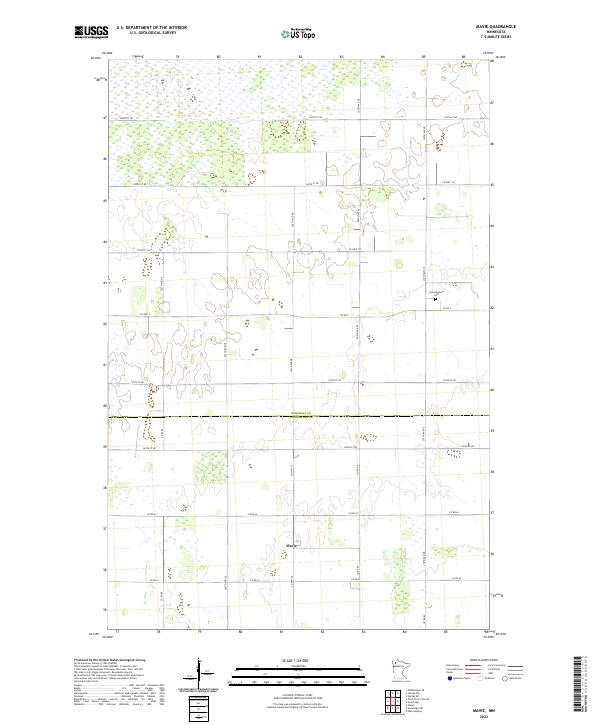
2022 Map of Mavie
USGS Topo · Published 2022About this map
Mavie serves as the central focal point of this rural landscape, situated just south of the border dividing Marshall Co and Pennington Co. The terrain is defined by an extensive network of wetlands and seasonal water bodies, particularly concentrated in the northern sections of the map. A strict orthogonal grid of section lines and gravel roads, including Co Hwy 2 and Co Rd 64, imposes order on the low-lying prairie and marshland. Located in the northeastern quadrant, the Germantown Cem provides a significant touchstone for genealogical research, marking the location of an early community in this pocket of northern Minnesota. This survey by the U.S. Geological Survey documents the contemporary agricultural and natural state of the region, illustrating the persistence of small settlements and traditional land divisions in the modern era.
Find a feature on this map
17 named features on this map. Tap any name to fly to it.
Don’t see what you’re looking for? This feature index may not catch every label — zoom into the map to look around manually.
Map Details
Editions of this 2022 Mavie Map
This is the sole edition of this map. No revisions or reprints were ever made.
Other maps of this area

1918 · Rollis
USGS Topo · 1:62,500

1918 · Middle River
USGS Topo · 1:62,500

1943 · Rollis
USGS Topo · 1:62,500

1943 · Thief River Falls
USGS Topo · 1:62,500

1952 · Thief River Falls
USGS Topo · 1:250,000

1954 · Roseau
USGS Topo · 1:250,000

1956 · Thief River Falls
USGS Topo · 1:250,000

1957 · Roseau
USGS Topo · 1:250,000

1957 · Thief River Falls
USGS Topo · 1:250,000

1958 · Roseau
USGS Topo · 1:250,000