
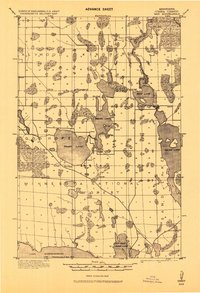
1919 Map of Max
USGS Topo · Published 1919About this map
The Minnesota National Forest defines this northern landscape just after the first world war, covering a network of significant glacial lakes and river systems. Small settlements like Max and Popple are positioned near these waterways, which served as vital corridors for the local economy. The upper reaches of Lake Winnibigoshish and the Big Fork River dominate the southern and eastern portions of the quadrangle, illustrating the complex hydrology of Itasca County. The survey records several rural schools located near Squaw Lake and Round Lake, reflecting the scattered community structure of the era. The presence of the 12th Standard Parallel North and various township boundaries like Alwood and Kinghurst provide a clear view of how the land was organized for forestry and settlement before the expansion of modern infrastructure.
Find a feature on this map
23 named features on this map. Tap any name to fly to it.
Don’t see what you’re looking for? This feature index may not catch every label — zoom into the map to look around manually.
Map Details
Editions of this 1919 Max Map
2 editions found
Other maps of this area

1918 · Zora
USGS Topo · 1:62,500

1919 · Rosy
USGS Topo · 1:62,500

1919 · Zora
USGS Topo · 1:62,500

1919 · Gemmell
USGS Topo · 1:62,500

1919 · Bridgie
USGS Topo · 1:62,500

1924 · Bridgie
USGS Topo · 1:62,500

1954 · Bemidji
USGS Topo · 1:250,000

1954 · Hibbing
USGS Topo · 1:250,000

1957 · Bemidji
USGS Topo · 1:250,000

1957 · Hibbing
USGS Topo · 1:250,000