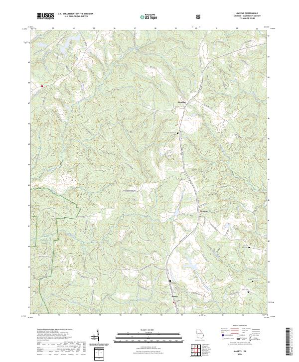
2024 Map of Maxeys
USGS Topo · Published 2024About this map
Maxeys and Stephens anchor this Oglethorpe County landscape, where the agricultural past meets the protected woodlands of the Oconee National Forest. The geography is defined by a dense network of watercourses including the North Fork Little River and Sandy Creek, which drain a region characterized by small-scale settlements and dispersed rural homesteads. The map reveals a high concentration of small burial grounds, such as the McWhorter Cem and Moody Cem, pointing to the long-standing family lineages of this Georgia piedmont area.
Find a feature on this map
68 named features on this map. Tap any name to fly to it.
Don’t see what you’re looking for? This feature index may not catch every label — zoom into the map to look around manually.
Map Details
Editions of this 2024 Maxeys Map
This is the sole edition of this map. No revisions or reprints were ever made.
Other maps of this area

1953 · Athens
USGS Topo · 1:250,000

1958 · Athens
USGS Topo · 1:250,000

1959 · Athens
USGS Topo · 1:250,000

1963 · Athens
USGS Topo · 1:250,000

1964 · Barnett Shoals
USGS Topo · 1:24,000
1964 · Athens East
USGS Topo · 1:24,000

1965 · Woodville
USGS Topo · 1:24,000
1971 · Sandy Cross
USGS Topo · 1:24,000
1971 · Crawford
USGS Topo · 1:24,000

1971 · Maxeys
USGS Topo · 1:24,000