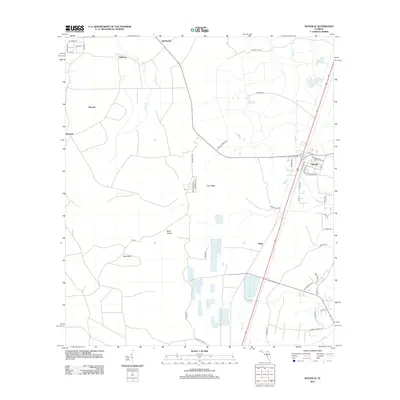
2012 Map of Maxville
USGS Topo · Published 2012About this map
Maxville serves as the primary hub of this area, situated at the junction where Macclenny Rd and Max Middleburg Rd converge. The settlement pattern here is characterized by scattered rural communities including McPherson, Bessent, Steckert, and Hugh, all connected by a web of logging roads and trails through the pine-dominated landscape. The topography is defined by the prominent Trail Ridge, a significant geological landform that influences the drainage of local waterways like Turkey Cr and Long Br. To the west, the terrain transitions into distinctive areas known as Buck Island and Big Island, which are surrounded by lower-lying drainage basins. The road network, including the precisely mapped streets of the LaBuena area such as Mulberry St and Oak St, reflects the slow but steady development of this timber and agriculture region.
Find a feature on this map
51 named features on this map. Tap any name to fly to it.
Don’t see what you’re looking for? This feature index may not catch every label — zoom into the map to look around manually.
Map Details
Editions of this 2012 Maxville Map
This is the sole edition of this map. No revisions or reprints were ever made.
Other maps of this area

1917 · Cambon
USGS Topo · 1:62,500

1917 · Macclenny
USGS Topo · 1:62,500

1918 · Middleburg
USGS Topo · 1:62,500

1918 · Lawtey
USGS Topo · 1:62,500

1918 · Cambon
USGS Topo · 1:62,500

1918 · Macclenny
USGS Topo · 1:62,500

1941 · Middleburg
USGS Topo · 1:62,500

1948 · Jacksonville
USGS Topo · 1:250,000

1949 · Middleburg SW
USGS Topo · 1:24,000

1949 · Fiftone
USGS Topo · 1:24,000