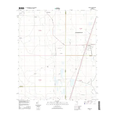
2015 Map of Maxville
USGS Topo · Published 2015About this map
Maxville and its surrounding rural corridors sit at a unique geographic crossroads where the borders of Duval, Baker, Clay, and Bradford counties converge. This 2015 survey reveals a landscape defined by the prominent Trail Ridge formation and extensive wetlands, including named island-like elevations such as Buck Island and Big Island. The settlement pattern is anchored by small communities like Hugh, Mcpherson, and Labuena, connected by a network of rural routes such as Normandy Blvd and S Co Rd 228. The drainage of the region is traced through numerous watercourses, including Turkey Cr, Long Br, and Deep Cr. This modern data provides a clear record of land use and property boundaries, specifically the Jacksonville city limits, in an area where forest management and small-town residential pockets dominate the terrain.
Find a feature on this map
58 named features on this map. Tap any name to fly to it.
Don’t see what you’re looking for? This feature index may not catch every label — zoom into the map to look around manually.
Map Details
Editions of this 2015 Maxville Map
This is the sole edition of this map. No revisions or reprints were ever made.
Other maps of this area

1917 · Cambon
USGS Topo · 1:62,500

1917 · Macclenny
USGS Topo · 1:62,500

1918 · Middleburg
USGS Topo · 1:62,500

1918 · Lawtey
USGS Topo · 1:62,500

1918 · Cambon
USGS Topo · 1:62,500

1918 · Macclenny
USGS Topo · 1:62,500

1941 · Middleburg
USGS Topo · 1:62,500

1948 · Jacksonville
USGS Topo · 1:250,000

1949 · Middleburg SW
USGS Topo · 1:24,000

1949 · Fiftone
USGS Topo · 1:24,000