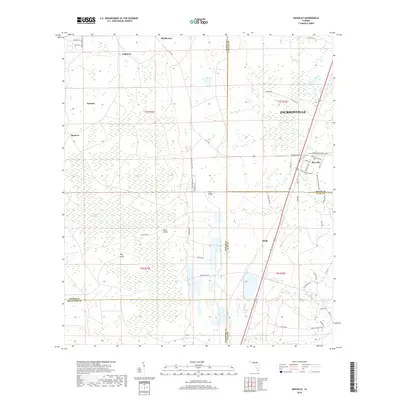
2018 Map of Maxville
USGS Topo · Published 2018About this map
Maxville and the surrounding rural landscape of the Jacksonville metropolitan periphery are defined by a network of small settlements and expansive wetlands in this 2018 survey. The western portions of the map are dominated by the New River Swamp, containing named rises such as Buck Island and Big Island. This area represents a significant hydrologic divide, where the headwaters of several systems emerge from the swampy interior. Settlement is concentrated along the transportation corridors of the east, particularly around the community of Maxville and the smaller locality of Hugh. Local roads like Co Rd 228 and Normandy Blvd connect these outposts to the broader region. The geography is further marked by Trail Ridge, a prominent geological feature that runs through the center of the sheet, influencing the drainage patterns of Turkey Cr and Deep Cr.
Find a feature on this map
61 named features on this map. Tap any name to fly to it.
Don’t see what you’re looking for? This feature index may not catch every label — zoom into the map to look around manually.
Map Details
Editions of this 2018 Maxville Map
This is the sole edition of this map. No revisions or reprints were ever made.
Other maps of this area

1917 · Cambon
USGS Topo · 1:62,500

1917 · Macclenny
USGS Topo · 1:62,500

1918 · Middleburg
USGS Topo · 1:62,500

1918 · Lawtey
USGS Topo · 1:62,500

1918 · Cambon
USGS Topo · 1:62,500

1918 · Macclenny
USGS Topo · 1:62,500

1941 · Middleburg
USGS Topo · 1:62,500

1948 · Jacksonville
USGS Topo · 1:250,000

1949 · Middleburg SW
USGS Topo · 1:24,000

1949 · Fiftone
USGS Topo · 1:24,000