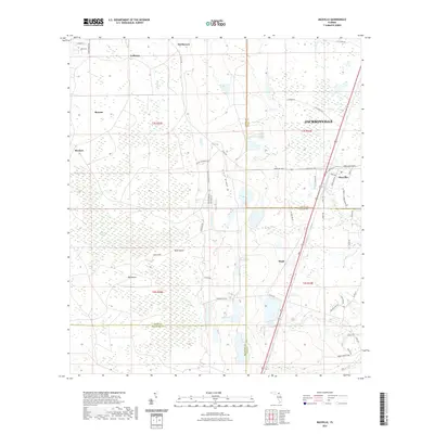
2021 Map of Maxville
USGS Topo · Published 2021About this map
Maxville and the surrounding rural landscape in western Duval County are defined by a complex intersection of county lines and extensive wetlands. This area, where Baker, Clay, and Bradford counties converge, features a distinct pattern of small settlements including LaBuena, McPherson, and Bessent. The landscape is dominated by the New River Swamp and significant terrain features like Buck Island and Big Island, which rise above the poorly drained pine flatwoods. The local road network, including Normandy Blvd and Co RD 218, connects these remote outposts to the larger Jacksonville metropolitan area. Local waterways like Long Br and Turkey Cr drain the sandy soils, while Tair Ridge provides a slight elevation contrast to the surrounding marshes. This map documents a quiet part of Florida where historical land names and family-linked settlements persist amidst the expanding suburban footprint of the northeast coast.
Find a feature on this map
57 named features on this map. Tap any name to fly to it.
Don’t see what you’re looking for? This feature index may not catch every label — zoom into the map to look around manually.
Map Details
Editions of this 2021 Maxville Map
This is the sole edition of this map. No revisions or reprints were ever made.
Other maps of this area

1917 · Cambon
USGS Topo · 1:62,500

1917 · Macclenny
USGS Topo · 1:62,500

1918 · Middleburg
USGS Topo · 1:62,500

1918 · Lawtey
USGS Topo · 1:62,500

1918 · Cambon
USGS Topo · 1:62,500

1918 · Macclenny
USGS Topo · 1:62,500

1941 · Middleburg
USGS Topo · 1:62,500

1948 · Jacksonville
USGS Topo · 1:250,000

1949 · Middleburg SW
USGS Topo · 1:24,000

1949 · Fiftone
USGS Topo · 1:24,000