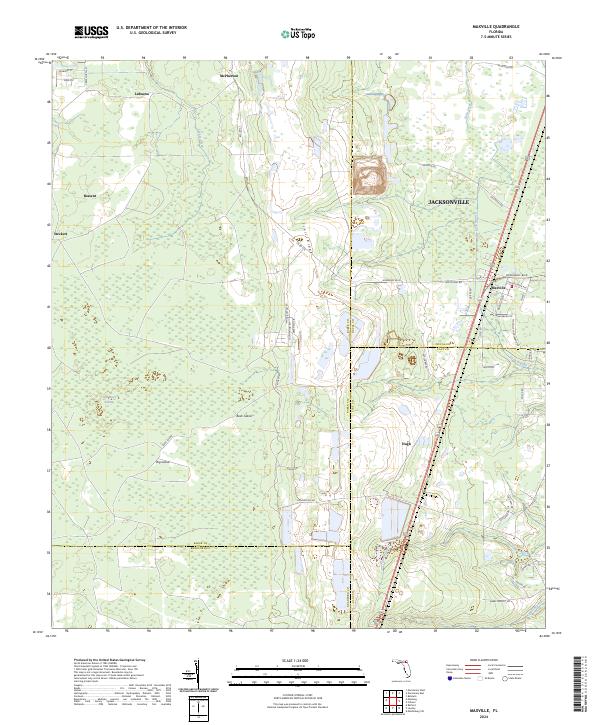
2024 Map of Maxville
USGS Topo · Published 2024About this map
Trail Ridge dominates the central landscape of this Baker County borderland, where the low-lying New River Swamp transitions into the higher ground of the northeast. This modern survey illustrates the intersection of rural heritage and the western expansion of Jacksonville, particularly around the settlement of Maxville. The quadrangle serves as a point of convergence for Baker, Duval, Clay, and Bradford counties, highlighting how jurisdictional lines bisect the Florida pine and wetlands. Notable local identifiers include Buck Island and Big Island, which rise above the surrounding swampy terrain, and established settlements like Bessent and LaBuena. The drainage patterns of Turkey Creek and Deep Creek define the natural boundaries between these small communities and the larger transport corridors of Normandy Blvd and Macclenny Rd.
Find a feature on this map
59 named features on this map. Tap any name to fly to it.
Don’t see what you’re looking for? This feature index may not catch every label — zoom into the map to look around manually.
Map Details
Editions of this 2024 Maxville Map
This is the sole edition of this map. No revisions or reprints were ever made.
Other maps of this area

1917 · Cambon
USGS Topo · 1:62,500

1917 · Macclenny
USGS Topo · 1:62,500

1918 · Middleburg
USGS Topo · 1:62,500

1918 · Lawtey
USGS Topo · 1:62,500

1918 · Cambon
USGS Topo · 1:62,500

1918 · Macclenny
USGS Topo · 1:62,500

1941 · Middleburg
USGS Topo · 1:62,500

1948 · Jacksonville
USGS Topo · 1:250,000

1949 · Middleburg SW
USGS Topo · 1:24,000

1949 · Fiftone
USGS Topo · 1:24,000