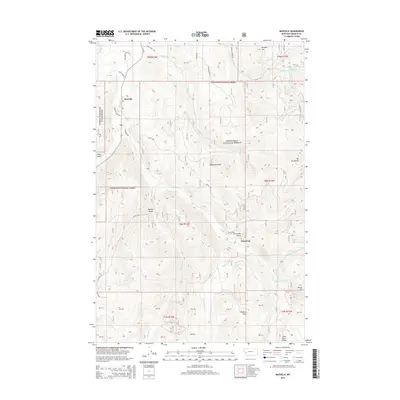
2014 Map of Maxville
USGS Topo · Published 2014About this map
Maxville and Princeton anchor this mid-2010s survey of the Flint Creek Range foothills, where historical mining and ranching interests meet the protected lands of the Deerlodge National Forest. The landscape is defined by a dense network of watercourses, including Flint Creek and the many-forked Boulder Creek, which carve through deep drainages like Princeton Gulch and Wyman Gulch. High points such as Douglas Mountain and Mount Princeton overlook a terrain marked by private land parcels and forest boundaries. The road network, featuring Maxville Road and Gird Creek Road, illustrates the ongoing relationship between these isolated settlements and the surrounding wilderness. Notable landmarks like Hickey Hill and Pierre Hill provide clear reference points for those studying the complex topography of this Granite County corridor.
Find a feature on this map
46 named features on this map. Tap any name to fly to it.
Don’t see what you’re looking for? This feature index may not catch every label — zoom into the map to look around manually.
Map Details
Editions of this 2014 Maxville Map
This is the sole edition of this map. No revisions or reprints were ever made.
Other maps of this area

1908 · Philipsburg
USGS Topo · 1:125,000

1919 · Drummond
USGS Topo · 1:125,000

1921 · Drummond
USGS Topo · 1:125,000

1947 · Butte
USGS Topo · 1:250,000

1958 · Butte
USGS Topo · 1:250,000

1958 · Drummond
USGS Topo · 1:62,500

1959 · Bearmouth
USGS Topo · 1:62,500

1960 · Butte
USGS Topo · 1:250,000

1962 · Butte
USGS Topo · 1:250,000

1971 · Henderson Mountain
USGS Topo · 1:24,000