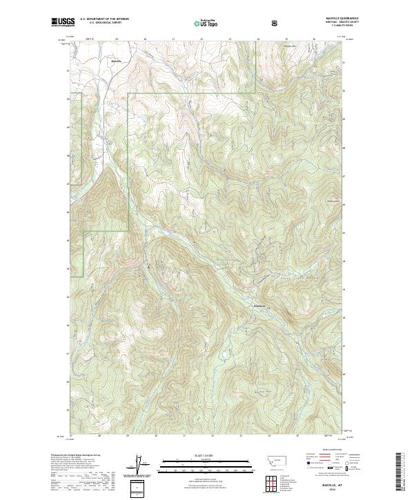
2024 Map of Maxville
USGS Topo · Published 2024About this map
Maxville and the mountain settlement of Princeton sit at the western edge of the Flint Creek Range in this Granite County survey. The landscape is defined by the steep elevation gains of the Deerlodge National Forest, where drainages like Princeton Gulch and Wyman Gulch carve into the high country. Water is central to the area's geography, with the Flint Creek valley providing the primary corridor for travel while its tributaries, including Boulder Creek and South Boulder Creek, reach deep into the timbered slopes. High points such as Douglas Mtn and Mt Princeton tower over the narrow valleys, connected by a network of forest roads and local routes like Maxville Rd and Gird Creek Rd. The presence of Royal Gold Creek and Little Gold Creek suggests a legacy of prospecting in these gulches, while contemporary land divisions like PB 41 indicate modern management of these traditional mountain lands.
Find a feature on this map
46 named features on this map. Tap any name to fly to it.
Don’t see what you’re looking for? This feature index may not catch every label — zoom into the map to look around manually.
Map Details
Editions of this 2024 Maxville Map
This is the sole edition of this map. No revisions or reprints were ever made.
Other maps of this area

1908 · Philipsburg
USGS Topo · 1:125,000

1919 · Drummond
USGS Topo · 1:125,000

1921 · Drummond
USGS Topo · 1:125,000

1947 · Butte
USGS Topo · 1:250,000

1958 · Butte
USGS Topo · 1:250,000

1958 · Drummond
USGS Topo · 1:62,500

1959 · Bearmouth
USGS Topo · 1:62,500

1960 · Butte
USGS Topo · 1:250,000

1962 · Butte
USGS Topo · 1:250,000

1971 · Henderson Mountain
USGS Topo · 1:24,000