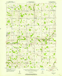
1952 Map of Maxville
USGS Topo · Published 1953About this map
The White River flows through the heart of this Randolph County landscape, a region defined by its productive farmland and late-era steam rail network. The New York Central and Pennsylvania railroads cut through the townships, supporting the small grain-handling and residential centers of Farmland and Maxville. Social and community hubs are prominently recorded, including the Moorman Orphanage and several rural schools and churches like the Lincoln Sch and North White River Ch.
Find a feature on this map
35 named features on this map. Tap any name to fly to it.
Don’t see what you’re looking for? This feature index may not catch every label — zoom into the map to look around manually.
Map Details
Editions of this 1952 Maxville Map
2 editions found
Other maps of this area

1915 · Fort Recovery
USGS Topo · 1:48,000

1916 · Winchester
USGS Topo · 1:48,000

1918 · Winchester
USGS Topo · 1:62,500

1918 · Fort Recovery
USGS Topo · 1:62,500

1943 · Winchester
USGS Topo · 1:62,500

1952 · Maxville
USGS Topo · 1:24,000

1952 · Farmland
USGS Topo · 1:24,000

1953 · Muncie
USGS Topo · 1:250,000

1956 · Muncie
USGS Topo · 1:250,000

1960 · Carlos
USGS Topo · 1:24,000