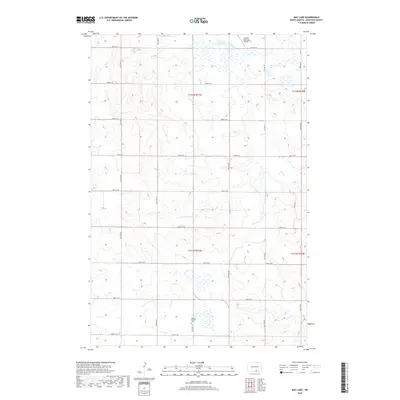
2018 Map of May Lake
USGS Topo · Published 2018About this map
May Lake and the surrounding prairie of McIntosh County are documented in this 2018 survey, reflecting the persistent grid of section lines that define North Dakota's agricultural landscape. The area is characterized by a high density of small wetlands and depressions typical of the Missouri Coteau region. A significant site for local history and genealogy is the Danzig Baptist Cem, located in the southern portion of the quadrangle along 88th St SE. This cemetery serves as a physical record of the early German-Russian settlement patterns that established the region's religious and social foundations. To the north, the Wishek Municipal Airport marks the transition toward the city of Wishek, while a network of rural roads such as 81st St SE and 84th St SE provide the framework for the modern farming operations that continue to shape the land.
Find a feature on this map
17 named features on this map. Tap any name to fly to it.
Don’t see what you’re looking for? This feature index may not catch every label — zoom into the map to look around manually.
Map Details
Editions of this 2018 May Lake Map
This is the sole edition of this map. No revisions or reprints were ever made.
Other maps of this area

1953 · Jamestown
USGS Topo · 1:250,000

1956 · Jamestown
USGS Topo · 1:250,000

1982 · Wishek SW
USGS Topo · 1:24,000

1982 · Danzig
USGS Topo · 1:24,000

1982 · May Lake NW
USGS Topo · 1:24,000

1982 · May Lake SW
USGS Topo · 1:24,000

1982 · May Lake
USGS Topo · 1:24,000
1982 · May Lake SE
USGS Topo · 1:24,000

1982 · Lehr SW
USGS Topo · 1:24,000
1982 · Ashley West
USGS Topo · 1:24,000