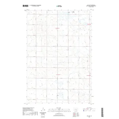
2020 Map of May Lake
USGS Topo · Published 2020About this map
May Lake and the surrounding prairie of McIntosh County define this quiet landscape of the northern Great Plains. The map captures the agricultural grid of the region, where section lines are traced by a network of gravel roads including 81st St SE and 37th Ave Se. This rural layout is anchored by the community of Wishek, which sits at the northern edge of the quadrangle. A significant point of local interest for genealogists and history enthusiasts is the Danzig Baptist Cem, located in the southern portion of the sheet. The inclusion of the Wishek Municipal Airport illustrates the modern infrastructure serving this remote farming district. The terrain is marked by numerous small wetlands and depressions characteristic of the glaciated plains, with elevation shifts clearly delineated across the townships of t132n r71w and t131n r71w.
Find a feature on this map
23 named features on this map. Tap any name to fly to it.
Don’t see what you’re looking for? This feature index may not catch every label — zoom into the map to look around manually.
Map Details
Editions of this 2020 May Lake Map
This is the sole edition of this map. No revisions or reprints were ever made.
Other maps of this area

1953 · Jamestown
USGS Topo · 1:250,000

1956 · Jamestown
USGS Topo · 1:250,000

1982 · Wishek SW
USGS Topo · 1:24,000

1982 · Danzig
USGS Topo · 1:24,000

1982 · May Lake NW
USGS Topo · 1:24,000

1982 · May Lake SW
USGS Topo · 1:24,000

1982 · May Lake
USGS Topo · 1:24,000
1982 · May Lake SE
USGS Topo · 1:24,000

1982 · Lehr SW
USGS Topo · 1:24,000
1982 · Ashley West
USGS Topo · 1:24,000