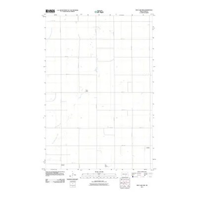
2011 Map of May Lake NW
USGS Topo · Published 2011About this map
South Branch Beaver Creek meanders through the northwest and southwest corners of this McIntosh County landscape, anchoring a rural grid of sectional roads. The 2011 survey reveals a landscape largely defined by agricultural continuity, marked by a significant concentration of communal burial grounds that serve as touchstones for local family history. Genealogists and researchers can identify the locations of Beaver Creek Cemetery, Ebenezer Cemetery, Old Kassel Cemetery, and Saint Johns Cemetery, which are distributed across the township lines. The strictly organized road network, including 81st St SE and 31st Ave SE, follows the traditional Public Land Survey System, illustrating how late-twentieth-century infrastructure remained bound to historic property boundaries in this part of North Dakota.
Find a feature on this map
20 named features on this map. Tap any name to fly to it.
Don’t see what you’re looking for? This feature index may not catch every label — zoom into the map to look around manually.
Map Details
Editions of this 2011 May Lake NW Map
This is the sole edition of this map. No revisions or reprints were ever made.
Other maps of this area

1953 · Jamestown
USGS Topo · 1:250,000

1956 · Jamestown
USGS Topo · 1:250,000

1979 · Schell Buttes
USGS Topo · 1:24,000
1980 · Hague SE
USGS Topo · 1:24,000

1982 · Wishek SW
USGS Topo · 1:24,000

1982 · May Lake NW
USGS Topo · 1:24,000

1982 · May Lake SW
USGS Topo · 1:24,000

1982 · May Lake
USGS Topo · 1:24,000
1982 · May Lake SE
USGS Topo · 1:24,000

1982 · Wishek
USGS Topo · 1:24,000