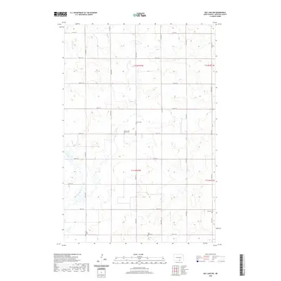
2020 Map of May Lake NW
USGS Topo · Published 2020About this map
Beaver Creek Baptist Cem and Neudorf Cem sit along the winding drainage of the S Br Beaver Cr, defining a landscape rooted in the rural cemetery traditions of McIntosh County. This territory is characterized by its organized grid of secondary roads, including 85th St SE and 87th St SE, which provide access to scattered burial sites like Old Kassel Cem and Saint Johns Cem. The distribution of these named sites suggests a history of localized township communities and parish clusters that once formed the backbone of this prairie region. Near the eastern boundary, Ebenezer Cem further marks the enduring presence of early families and congregations in a landscape primarily dedicated to agriculture and open space.
Find a feature on this map
19 named features on this map. Tap any name to fly to it.
Don’t see what you’re looking for? This feature index may not catch every label — zoom into the map to look around manually.
Map Details
Editions of this 2020 May Lake NW Map
This is the sole edition of this map. No revisions or reprints were ever made.
Other maps of this area

1953 · Jamestown
USGS Topo · 1:250,000

1956 · Jamestown
USGS Topo · 1:250,000

1979 · Schell Buttes
USGS Topo · 1:24,000
1980 · Hague SE
USGS Topo · 1:24,000

1982 · Wishek SW
USGS Topo · 1:24,000

1982 · May Lake NW
USGS Topo · 1:24,000

1982 · May Lake SW
USGS Topo · 1:24,000

1982 · May Lake
USGS Topo · 1:24,000
1982 · May Lake SE
USGS Topo · 1:24,000

1982 · Wishek
USGS Topo · 1:24,000