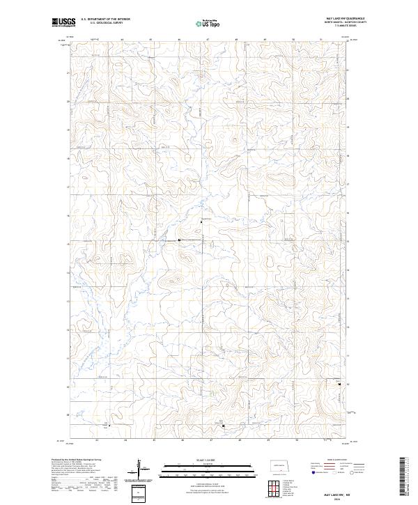
2024 Map of May Lake NW
USGS Topo · Published 2024About this map
The drainage of South Branch Beaver Creek carves a path through this section of McIntosh County, defining a rural landscape shaped by the Public Land Survey System. The map reveals the deep roots of local pioneer and immigrant heritage through several family and community-aligned burial sites. Genealogists and historians will find significance in the presence of Old Kassel Cem, Beaver Creek Baptist Cem, and Saint Johns Cem, which represent the early spiritual and social centers of this prairie region. The grid-like road network, consisting of thoroughfares such as 81st St SE and 33rd Ave SE, illustrates the persistent township and range structure that has governed North Dakota’s agricultural development. Other local landmarks like Neudorf Cem and Ebenezer Cem stand as quiet markers of the families who settled these sections during the territory's expansion.
Find a feature on this map
26 named features on this map. Tap any name to fly to it.
Don’t see what you’re looking for? This feature index may not catch every label — zoom into the map to look around manually.
Map Details
Editions of this 2024 May Lake NW Map
This is the sole edition of this map. No revisions or reprints were ever made.
Other maps of this area

1953 · Jamestown
USGS Topo · 1:250,000

1956 · Jamestown
USGS Topo · 1:250,000

1979 · Schell Buttes
USGS Topo · 1:24,000
1980 · Hague SE
USGS Topo · 1:24,000

1982 · Wishek SW
USGS Topo · 1:24,000

1982 · May Lake NW
USGS Topo · 1:24,000

1982 · May Lake SW
USGS Topo · 1:24,000

1982 · May Lake
USGS Topo · 1:24,000
1982 · May Lake SE
USGS Topo · 1:24,000

1982 · Wishek
USGS Topo · 1:24,000