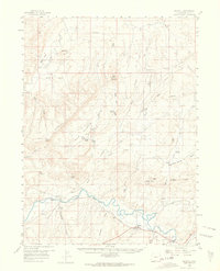
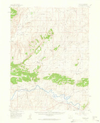
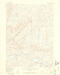
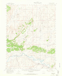
1958 Map of Maybell
USGS Topo · Published 1964About this map
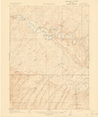
The Yampa River and Little Snake River converge in this high-desert landscape of Northwest Colorado, where the water economy is defined by landmarks like the Lay Ditch and a riverside Pumping Sta. The small settlement of Maybell serves as the primary hub, situated near the sweeping Boston Flat and the meandering riverbanks. This era captures the area's transition into mid-century resource management, evidenced by the prominent Pipeline cutting across the terrain and a Strip Mine located in the southeastern quadrant.
Find a feature on this map
47 named features on this map. Tap any name to fly to it.
Don’t see what you’re looking for? This feature index may not catch every label — zoom into the map to look around manually.
Map Details
Editions of this 1958 Maybell Map
4 editions found
Other maps of this area

1907 · White River
USGS Topo · 1:125,000

1910 · Danforth Hills
USGS Topo · 1:125,000

1910 · White River
USGS Topo · 1:125,000

1912 · Axial
USGS Topo · 1:62,500
1914 · Axial
USGS Topo · 1:62,500

1916 · Craig
USGS Topo · 1:125,000

1954 · Vernal
USGS Topo · 1:250,000

1954 · Craig
USGS Topo · 1:250,000

1957 · Craig
USGS Topo · 1:250,000

1958 · Vernal
USGS Topo · 1:250,000