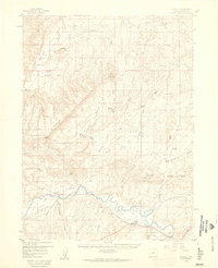
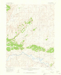
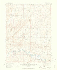
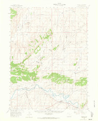
1958 Map of Maybell
USGS Topo · Published 1960About this map
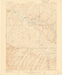
The Yampa River meanders through the southern reaches of this landscape, its path tracked by the Maybell Ditch and the Thornburg Trail. In the late 1950s, the small community of Maybell serves as a local hub near the Boston Flat, while the settlement of Sunbeam sits further west along the river. This area is defined by its complex irrigation and water management, evidenced by the numerous springs like Brouse Spring and Redrock Spring that dot the slopes of Godiva Mountain.
Find a feature on this map
47 named features on this map. Tap any name to fly to it.
Don’t see what you’re looking for? This feature index may not catch every label — zoom into the map to look around manually.
Map Details
Editions of this 1958 Maybell Map
4 editions found
Other maps of this area

1907 · White River
USGS Topo · 1:125,000

1910 · Danforth Hills
USGS Topo · 1:125,000

1910 · White River
USGS Topo · 1:125,000

1912 · Axial
USGS Topo · 1:62,500
1914 · Axial
USGS Topo · 1:62,500

1916 · Craig
USGS Topo · 1:125,000

1954 · Vernal
USGS Topo · 1:250,000

1954 · Craig
USGS Topo · 1:250,000

1957 · Craig
USGS Topo · 1:250,000

1958 · Vernal
USGS Topo · 1:250,000