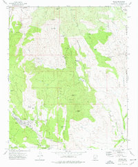
1974 Map of Mayer
USGS Topo · Published 1977About this map
The settlement of Mayer serves as the focal point for this Yavapai County landscape in the mid-1970s, where the winding Agua Fria River and its numerous desert drainages define the terrain. Traces of the region's industrial past are prominent, particularly the Old Railroad Grade and Old RR Grade that parallel Bug Creek and Hackberry Creek. The map records a dense concentration of mineral exploration sites, including the Big Bug Mine, Binghampton Mine, Copper Queen Mine, and the Stoddard Mine located near Stoddard Spring.
Find a feature on this map
50 named features on this map. Tap any name to fly to it.
Don’t see what you’re looking for? This feature index may not catch every label — zoom into the map to look around manually.
Map Details
Editions of this 1974 Mayer Map
This is the sole edition of this map. No revisions or reprints were ever made.
Other maps of this area

1887 · Prescott
USGS Topo · 1:250,000

1892 · Prescott
USGS Topo · 1:250,000

1903 · Bradshaw Mountains
USGS Topo · 1:125,000

1905 · Jerome
USGS Topo · 1:125,000

1944 · Mingus Mountain
USGS Topo · 1:62,500

1947 · Mingus Mtn
USGS Topo · 1:62,500

1947 · Mayer
USGS Topo · 1:62,500

1947 · Mt. Union
USGS Topo · 1:62,500

1947 · Prescott
USGS Topo · 1:62,500

1948 · Mt. Union
USGS Topo · 1:63,360