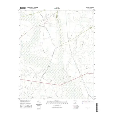
2017 Map of Mayesville
USGS Topo · Published 2017About this map
The Scape Ore Swamp and Black River dominate this low-country landscape of eastern Sumter County and southern Lee County. The town of Mayesville serves as the primary hub, situated near the Mayesville Black River Cem and surrounded by a network of rural crossroads and river crossings. The terrain is characterized by intricate wetlands and drainage systems, including Rocky Bluff Swamp, Church Br, and Concord Br, which historically dictated the placement of settlements and roads. Small rural communities and landmarks such as Scottsville, Brunsons Store, and Beulah Cem are connected by a web of local roads like Eastern School Rd and Brick Church Rd. This survey illustrates the persistent agricultural and swamp-bordering settlement patterns of the South Carolina coastal plain, where geographic features like Muldrows Crossing and McBride Crossing remain as vital orientation points for local history and land use.
Find a feature on this map
61 named features on this map. Tap any name to fly to it.
Don’t see what you’re looking for? This feature index may not catch every label — zoom into the map to look around manually.
Map Details
Editions of this 2017 Mayesville Map
This is the sole edition of this map. No revisions or reprints were ever made.
Other maps of this area

1920 · Mayesville
USGS Topo · 1:48,000

1921 · Mayesville
USGS Topo · 1:62,500

1941 · Spartanburg
USGS Topo · 1:250,000

1943 · Mayesville
USGS Topo · 1:62,500

1946 · Sumter
USGS Topo · 1:62,500

1953 · Spartanburg
USGS Topo · 1:250,000

1954 · Augusta
USGS Topo · 1:250,000

1957 · Sumter East
USGS Topo · 1:24,000

1957 · Ashwood
USGS Topo · 1:62,500

1957 · Sumter
USGS Topo · 1:62,500
Featured Places
- Mayesville, SC
- Scottsville, SC
- Brunsons Store, SC
- Mayesville East Subdivision, Mayesville
- Sumter County, SC