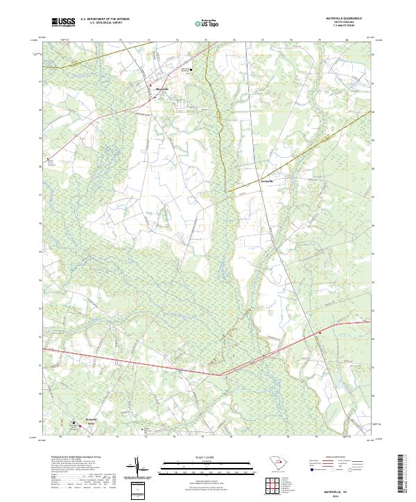
2024 Map of Mayesville
USGS Topo · Published 2024About this map
Mayesville serves as the primary hub in this portion of Sumter Co, South Carolina, where the local road network converges near the Lee Co line. The landscape is defined by the extensive Scape Ore Swamp and the Black River, which dictate the placement of rural settlements and agricultural fields. Notable for genealogists, the map identifies several spiritual and commemorative sites, including the Mayesville Black River Cem, Beulah Church, and Lewis Chapel Church. Small community centers like Scottsville and Brunsons Store are documented alongside an Abandoned Rd Rw, indicating shifts in the local transportation infrastructure. The map also features the English Memorial Park, preserving a modern record of civic landmarks within this traditionally agrarian coastal plain region.
Find a feature on this map
65 named features on this map. Tap any name to fly to it.
Don’t see what you’re looking for? This feature index may not catch every label — zoom into the map to look around manually.
Map Details
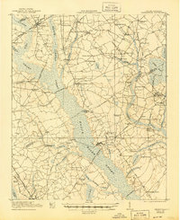
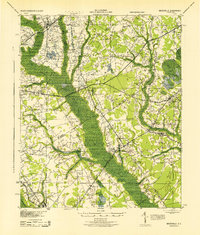
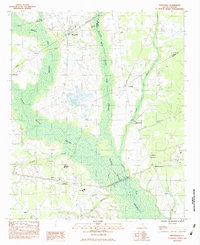
Editions of this 2024 Mayesville Map
This is the sole edition of this map. No revisions or reprints were ever made.
Historical Maps of Mayesville Through Time
5 maps found

Featured Locations
- Sumter County, SC
- Mayesville, SC
- Brunsons Store, SC
- Scottsville, SC
- Mayesville East Subdivision, Mayesville