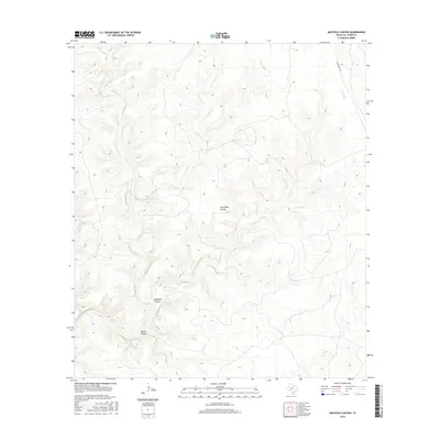
2016 Map of Mayfield Canyon
USGS Topo · Published 2016About this map
Cold Water Canyon and the surrounding drainage systems dominate this section of Val Verde County, characterized by a complex network of dry creek beds and steep-walled canyons. The area remains largely undeveloped, defined by its traditional ranching landscape where infrastructure is limited to primitive trails and the paved Ranch Rd 1024 which cuts across the northeastern corner. In the southern half of the sheet, Mayfield Canyon and Gobble Canyon converge, illustrating the hydrological patterns that have shaped this arid terrain over generations. This topographic study captures the isolation of the West Texas backcountry, where named geographic features serve as the primary landmarks for navigation and land management in a territory with few permanent settlements.
Find a feature on this map
4 named features on this map. Tap any name to fly to it.
Don’t see what you’re looking for? This feature index may not catch every label — zoom into the map to look around manually.
Map Details
Editions of this 2016 Mayfield Canyon Map
This is the sole edition of this map. No revisions or reprints were ever made.
Other maps of this area

1943 · Shumla
USGS Topo · 1:62,500

1944 · Baker Crossing
USGS Topo · 1:62,500

1954 · Sonora
USGS Topo · 1:250,000

1958 · Sonora
USGS Topo · 1:250,000

1958 · Del Rio
USGS Topo · 1:250,000

1964 · Del Rio
USGS Topo · 1:250,000

1970 · Everett Canyon
USGS Topo · 1:24,000

1970 · Sycamore Canyon
USGS Topo · 1:24,000

1970 · Blue Hills
USGS Topo · 1:24,000
1973 · Still Canyon
USGS Topo · 1:24,000