
2019 Map of Mayfield Canyon
USGS Topo · Published 2019About this map
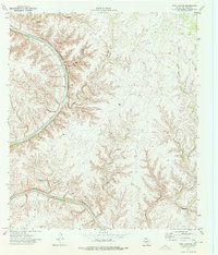
Mayfield Canyon dominates this 2019 study of the high desert plateau in Val Verde County, where a complex network of drainage systems carves through the limestone landscape. The map details the profound topographical relief of the region, featuring deep incisions such as Lewis Canyon and Gobble Canyon that branch out toward the Rio Grande drainage basin. These landforms reveal a stark, eroded environment defined by steep canyon walls and narrow arroyos. On the eastern edge of the quadrangle, Ranch Rd 1024 provides the primary transit corridor through this sparsely populated territory, while the western reaches are marked by the winding path of Cold Water Canyon. The spatial relationship between these natural conduits and the few human-engineered routes illustrates the challenges of navigation and land use in this part of West Texas.
Find a feature on this map
5 named features on this map. Tap any name to fly to it.
Don’t see what you’re looking for? This feature index may not catch every label — zoom into the map to look around manually.
Map Details
Editions of this 2019 Mayfield Canyon Map
This is the sole edition of this map. No revisions or reprints were ever made.
Other maps of this area

1943 · Shumla
USGS Topo · 1:62,500

1944 · Baker Crossing
USGS Topo · 1:62,500

1954 · Sonora
USGS Topo · 1:250,000

1958 · Sonora
USGS Topo · 1:250,000

1958 · Del Rio
USGS Topo · 1:250,000

1964 · Del Rio
USGS Topo · 1:250,000

1970 · Everett Canyon
USGS Topo · 1:24,000

1970 · Sycamore Canyon
USGS Topo · 1:24,000

1970 · Blue Hills
USGS Topo · 1:24,000
1973 · Still Canyon
USGS Topo · 1:24,000