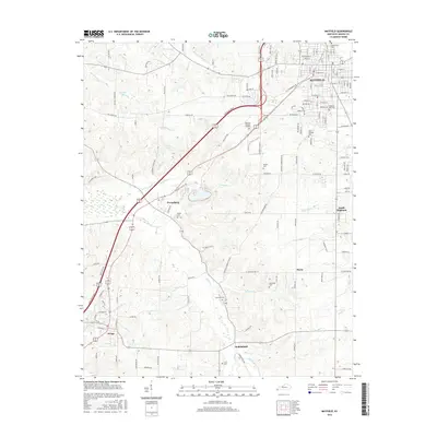
2016 Map of Mayfield
USGS Topo · Published 2016About this map
The city of Mayfield serves as the focal point for this survey of Graves County, situated at the intersection of major transit corridors like the Purchase Pkwy. The landscape transitions from the urban density of the county seat to the outlying agricultural communities of Pryorsburg, Wingo, and Stubblefield. Waterways such as Obion Cr and W Fork Mayfield Cr define the drainage patterns of the region, while small water bodies like Shotgun Lake and Sunset Lake dot the western reaches.
Find a feature on this map
142 named features on this map. Tap any name to fly to it.
Don’t see what you’re looking for? This feature index may not catch every label — zoom into the map to look around manually.
Map Details
Editions of this 2016 Mayfield Map
This is the sole edition of this map. No revisions or reprints were ever made.
Other maps of this area

1936 · Farmington
USGS Topo · 1:24,000

1936 · Westplains
USGS Topo · 1:24,000

1951 · Farmington
USGS Topo · 1:24,000

1951 · Hickory
USGS Topo · 1:24,000
1951 · Westplains
USGS Topo · 1:24,000

1951 · Hickory
USGS Topo · 1:62,500

1952 · Mayfield
USGS Topo · 1:24,000

1952 · Dublin
USGS Topo · 1:24,000

1952 · Cuba
USGS Topo · 1:24,000

1952 · Fancy Farm
USGS Topo · 1:24,000