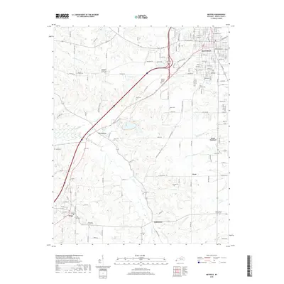
2019 Map of Mayfield
USGS Topo · Published 2019About this map
Mayfield serves as the focal point of this Graves County landscape, where the urban grid of the city meets a network of rural settlements and family cemeteries. The terrain is defined by the winding paths of McClane Cr, Obion Cr, and Kess Cr, which carve through the countryside toward smaller hubs like Pryorsburg and Wingo. This 2019 survey documents a landscape deeply rooted in its local heritage, evidenced by the high density of burial grounds and small-town congregations.
Find a feature on this map
160 named features on this map. Tap any name to fly to it.
Don’t see what you’re looking for? This feature index may not catch every label — zoom into the map to look around manually.
Map Details
Editions of this 2019 Mayfield Map
This is the sole edition of this map. No revisions or reprints were ever made.
Other maps of this area

1936 · Farmington
USGS Topo · 1:24,000

1936 · Westplains
USGS Topo · 1:24,000

1951 · Farmington
USGS Topo · 1:24,000

1951 · Hickory
USGS Topo · 1:24,000
1951 · Westplains
USGS Topo · 1:24,000

1951 · Hickory
USGS Topo · 1:62,500

1952 · Mayfield
USGS Topo · 1:24,000

1952 · Dublin
USGS Topo · 1:24,000

1952 · Cuba
USGS Topo · 1:24,000

1952 · Fancy Farm
USGS Topo · 1:24,000