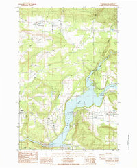
1984 Map of Mayfield Lake
USGS Topo · Published 1984About this map
Mayfield Lake dominates the central landscape of this Washington survey, where the Cowlitz River is harnessed for power and recreation. Along the northern shores, Ike Kinswa State Park provides designated camping and boat ramps, while the Mossyrock Trout Hatchery points to the importance of the local fishery. The topography transitions from the low-lying Klickitat Prairie in the southeast to the higher elevations of Burnt Ridge and Shoestring Valley in the north.
Find a feature on this map
42 named features on this map. Tap any name to fly to it.
Don’t see what you’re looking for? This feature index may not catch every label — zoom into the map to look around manually.
Map Details
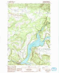
Editions of this 1984 Mayfield Lake Map
2 editions found
Other maps of this area

1916 · Chehalis
USGS Topo · 1:125,000

1919 · Mount St Helens
USGS Topo · 1:125,000

1937 · Eatonville
USGS Topo · 1:125,000

1942 · Toutle
USGS Topo · 1:62,500

1943 · Willapa
USGS Topo · 1:62,500

1953 · Hoquiam
USGS Topo · 1:250,000

1953 · Toutle
USGS Topo · 1:62,500

1953 · Elk Rock
USGS Topo · 1:62,500

1954 · Onalaska
USGS Topo · 1:62,500

1957 · Hoquiam
USGS Topo · 1:250,000