2012 Map of Mayfield
USGS Topo · Published 2012About this map
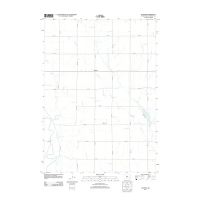
Mayfield stands at a central crossroads in this section of Yankton County, where the grid of rural section lines meets the winding course of Smoky Run. The landscape is defined by its drainage patterns, with the James River cutting through the western edge of the quadrangle and Clay Cr meandering through the eastern half. This map illustrates the intersection of mid-century agricultural organization and the natural topography of the Great Plains. Local history is anchored by the Walshtown Cem, situated south of the main settlement area. Near the eastern border, Marindahl Lake provides a notable point of interest, formed where Smoky Run and Clay Cr converge, surrounded by a network of local roads including Marindahl Ave and 300th St.
Find a feature on this map
22 named features on this map. Tap any name to fly to it.
Don’t see what you’re looking for? This feature index may not catch every label — zoom into the map to look around manually.
Map Details
Editions of this 2012 Mayfield Map
This is the sole edition of this map. No revisions or reprints were ever made.
Other maps of this area

1898 · Parker
USGS Topo · 1:125,000

1955 · Sioux City
USGS Topo · 1:250,000

1955 · Sioux Falls
USGS Topo · 1:250,000

1957 · Gayville
USGS Topo · 1:24,000

1957 · Mayfield
USGS Topo · 1:24,000

1957 · Midway
USGS Topo · 1:24,000

1957 · Mission Hill
USGS Topo · 1:24,000

1957 · Jamesville
USGS Topo · 1:24,000

1958 · Sioux City
USGS Topo · 1:250,000

1958 · Sioux Falls
USGS Topo · 1:250,000
Featured Places
- Mayfield, SD
- Walshtown Township, SD
- Marindahl Township, SD
- Mayfield Township, SD
- Turkey Valley Township, SD