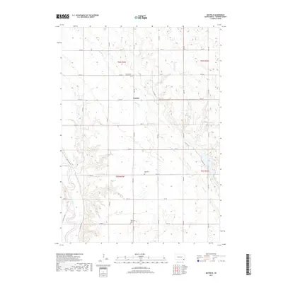
2017 Map of Mayfield
USGS Topo · Published 2017About this map
Mayfield sits at the intersection of rural Yankton County roads, serving as a focal point for the surrounding agricultural landscape in southeastern South Dakota. This region is defined by a series of drainage systems, including the southward-meandering Smoky Run and Clay Cr, which carve through the prairie towards the James River valley in the southwest. A legacy of early settlement is visible through several religious landmarks, most notably the Saint Columba Catholic Cem and the Walshdown Catholic Cem, which along with the Walshdown Cem, indicate the historical Catholic influence in this township. The presence of Marindahl Lake in the eastern portion of the map provides a significant break in the rolling terrain, while the extensive grid of numbered avenues and streets demonstrates the persistent organized land use of the northern Great Plains.
Find a feature on this map
32 named features on this map. Tap any name to fly to it.
Don’t see what you’re looking for? This feature index may not catch every label — zoom into the map to look around manually.
Map Details
Editions of this 2017 Mayfield Map
This is the sole edition of this map. No revisions or reprints were ever made.
Other maps of this area

1898 · Parker
USGS Topo · 1:125,000

1955 · Sioux City
USGS Topo · 1:250,000

1955 · Sioux Falls
USGS Topo · 1:250,000

1957 · Gayville
USGS Topo · 1:24,000

1957 · Mayfield
USGS Topo · 1:24,000

1957 · Midway
USGS Topo · 1:24,000

1957 · Mission Hill
USGS Topo · 1:24,000

1957 · Jamesville
USGS Topo · 1:24,000

1958 · Sioux City
USGS Topo · 1:250,000

1958 · Sioux Falls
USGS Topo · 1:250,000
Featured Places
- Mayfield, SD
- Walshtown Township, SD
- Marindahl Township, SD
- Mayfield Township, SD
- Turkey Valley Township, SD