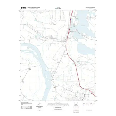
2011 Map of Mayflower
USGS Topo · Published 2011About this map
Lake Conway dominates the eastern landscape, defined by a complex of landings such as Ballard Landing and Edwards Landing that speak to the area's recreational and residential development. This 2011 topographic survey captures the intersection of major transport and water, where the Arkansas River carves a broad path through the west, creating features like Beaverdam Island and Fletcher Bend. The town of Mayflower serves as a central hub, situated near the Mayflower Cemetery and the Pine Village Airport. Further south, the map details the transition into West Marche and the lower reaches of Palarm Creek. The terrain is punctuated by significant elevations including Reynolds Mountain and Mount Pilgrim, while smaller water bodies like Jewell Lake and L D Rogers Lake illustrate the local drainage into the larger river basin. Notable historical and genealogical markers include Monnie Springs and the small settlement of Roland on the western bank of the river.
Find a feature on this map
115 named features on this map. Tap any name to fly to it.
Don’t see what you’re looking for? This feature index may not catch every label — zoom into the map to look around manually.
Map Details
Editions of this 2011 Mayflower Map
This is the sole edition of this map. No revisions or reprints were ever made.
Other maps of this area

1890 · Benton
USGS Topo · 1:125,000

1891 · Little Rock
USGS Topo · 1:125,000

1892 · Morrillton
USGS Topo · 1:125,000

1893 · Little Rock
USGS Topo · 1:125,000

1894 · Morrillton
USGS Topo · 1:125,000

1894 · Benton
USGS Topo · 1:125,000

1935 · North Little Rock
USGS Topo · 1:24,000

1943 · Pinnacle Mtn
USGS Topo · 1:31,680

1953 · Cato
USGS Topo · 1:24,000

1953 · Mayflower
USGS Topo · 1:24,000