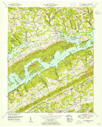
1952 Map of Maynardville
USGS Topo · Published 1954About this map
Maynardville serves as the focal point of this Tennessee valley, situated where the ridge-and-valley topography of Hickory Valley and Little Hickory Valley meets the sprawling waters of Norris Lake. The 1952 field revision reveals a landscape shaped by the Tennessee Valley Authority’s mid-century influence, with the Norris Reservation Boundary delineating public lands such as the Chuck Swan Management Area. While the rise of the reservoir fundamentally altered the Clinch River corridor, older settlement patterns remain visible through scattered rural hubs like Ellisons Store and Sharpe Chapel PO.
Find a feature on this map
97 named features on this map. Tap any name to fly to it.
Don’t see what you’re looking for? This feature index may not catch every label — zoom into the map to look around manually.
Map Details
Editions of this 1952 Maynardville Map
3 editions found
Other maps of this area

1897 · Maynardville
USGS Topo · 1:125,000

1900 · Maynardville
USGS Topo · 1:125,000

1935 · Luttrell
USGS Topo · 1:24,000

1935 · Straw Plains
USGS Topo · 1:48,000

1935 · Graveston
USGS Topo · 1:24,000

1935 · Well Spring
USGS Topo · 1:24,000

1936 · Gorryton
USGS Topo · 1:48,000

1936 · Powder Springs
USGS Topo · 1:24,000

1936 · Ausmus
USGS Topo · 1:24,000
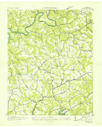
1936 · Clouds
USGS Topo · 1:24,000