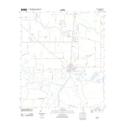
2012 Map of Mayo
USGS Topo · Published 2012About this map
The Suwannee River carves a winding path through this North Florida landscape, defining the northern boundary of a region where agriculture and natural springs converge. At the center of the survey lies the town of Mayo, serving as a hub for outlying communities such as Luraville, Peterson, and Alton. The area is characterized by a high concentration of water features and limestone sinks, including Peacock Springs, Telford Spring, and Perry Spring. For those researching local history, the map provides precise locations for family and community landmarks like Bethel Cem and Winburn Cem. The presence of The Trails Airport and the Mayo Lookout Tower reflects the specialized land use in this part of Lafayette County, where aviation and forestry management remain significant alongside the established dairy operations at Kerbys Dairy and Alton Dairy.
Find a feature on this map
92 named features on this map. Tap any name to fly to it.
Don’t see what you’re looking for? This feature index may not catch every label — zoom into the map to look around manually.
Map Details
Editions of this 2012 Mayo Map
This is the sole edition of this map. No revisions or reprints were ever made.
Other maps of this area

1954 · Mallory Swamp NW
USGS Topo · 1:24,000

1954 · Day SE
USGS Topo · 1:24,000

1954 · Day
USGS Topo · 1:24,000

1954 · Cooks Hammock
USGS Topo · 1:24,000

1954 · Dowling Park
USGS Topo · 1:24,000

1954 · Mallory Swamp NE
USGS Topo · 1:24,000

1954 · Gainesville
USGS Topo · 1:250,000

1954 · Valdosta
USGS Topo · 1:250,000

1955 · Mayo NE
USGS Topo · 1:24,000

1955 · Mayo
USGS Topo · 1:24,000