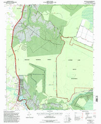
1994 Map of Maysville
USGS Topo · Published 1997About this map
The White Oak River defines the western edge of this mid-1990s survey, where the town of Maysville sits at the junction of rail and road. The landscape is dominated by the dense timberlands of the Croatan National Forest, extending eastward into the Catfish Lake South Wilderness. This era of the forest's management is visible through the network of access routes like Wilderness Road and Mattocks Road, alongside specialized conservation areas such as the Catfish Lake Waterfowl Impoundment.
Find a feature on this map
41 named features on this map. Tap any name to fly to it.
Don’t see what you’re looking for? This feature index may not catch every label — zoom into the map to look around manually.
Map Details
Editions of this 1994 Maysville Map
2 editions found
Other maps of this area

1901 · New Bern
USGS Topo · 1:62,500

1903 · New Bern
USGS Topo · 1:62,500

1903 · Trent River
USGS Topo · 1:62,500

1904 · Trent River
USGS Topo · 1:62,500

1942 · Maysville
USGS Topo · 1:62,500

1943 · Jacksonville
USGS Topo · 1:62,500

1948 · Maysville
USGS Topo · 1:62,500

1950 · Pollocksville
USGS Topo · 1:24,000

1950 · New Bern
USGS Topo · 1:24,000

1953 · Rocky Mount
USGS Topo · 1:250,000