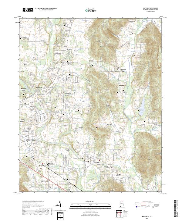
2024 Map of Maysville
USGS Topo · Published 2024About this map
The Flint River meanders through this portion of Madison County, framing a landscape where agricultural history and modern expansion meet. Early industrial sites such as Bell Factory, McCaleb Mill, and Moores Mill indicate the area's long-standing reliance on water power, while the presence of Wortham Mill near the river's edge highlights the historical milling operations once vital to local commerce. Settlements like Maysville, New Market, and Saint Clair Store serve as anchors for the surrounding rural communities, many of which are defined by small family-named landmarks and geographic features like Stillhouse Hollow and Branon Hollow. Numerous legacy burial grounds, including the Massengale Cem and Rogers Cem, provide important touchpoints for genealogists tracing the families that settled these valleys. The eastern edge is defined by higher elevations such as Nance Mtn and Jasper Point, which overlook Sharp Cove and the waters of Madison County Lake.
Find a feature on this map
242 named features on this map. Tap any name to fly to it.
Don’t see what you’re looking for? This feature index may not catch every label — zoom into the map to look around manually.
Map Details
Editions of this 2024 Maysville Map
This is the sole edition of this map. No revisions or reprints were ever made.
Other maps of this area

1888 · Scottsboro
USGS Topo · 1:125,000

1888 · Huntsville
USGS Topo · 1:125,000

1892 · Huntsville
USGS Topo · 1:125,000

1892 · Scottsboro
USGS Topo · 1:125,000

1936 · King Cove
USGS Topo · 1:24,000

1936 · Meridianville
USGS Topo · 1:24,000

1936 · Moontown
USGS Topo · 1:24,000

1936 · Fisk
USGS Topo · 1:24,000

1936 · Hollytree
USGS Topo · 1:24,000

1936 · Maysville
USGS Topo · 1:24,000