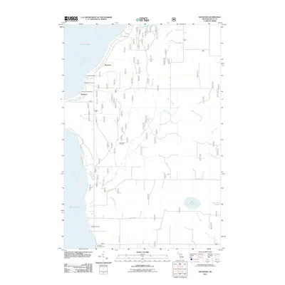
2011 Map of Maywood
USGS Topo · Published 2011About this map
Little Bay de Noc defines the western coastline of this peninsula landscape, where the settlement of Maywood serves as a central point for the surrounding rural community. The interior is characterized by a network of drainage systems, including Squaw Creek and Misery Creek, which move through the low-lying terrain toward the larger waters of Lake Michigan. This area is a site of local memory and congregation, evidenced by the Stonington Community Hall and several local burial grounds such as Lakewood Cemetery and Bay de Noc Cemetery. The presence of Slab Dock Campground and Maywood Campground suggests a long-standing relationship with seasonal recreation along the shoreline near Hunters Point. Further inland, isolated water bodies like Lake Sixteen and Schawe Lake break up the grid-like road pattern defined by routes such as School 18 Rd.
Find a feature on this map
25 named features on this map. Tap any name to fly to it.
Don’t see what you’re looking for? This feature index may not catch every label — zoom into the map to look around manually.
Map Details
Editions of this 2011 Maywood Map
This is the sole edition of this map. No revisions or reprints were ever made.
Other maps of this area

1932 · Gladstone NE
USGS Topo · 1:31,680

1932 · Rapid River NE
USGS Topo · 1:31,680

1932 · Gladstone SE
USGS Topo · 1:31,680

1932 · Rapid River NW
USGS Topo · 1:31,680

1932 · Rapid River SE
USGS Topo · 1:31,680

1932 · Rapid River SW
USGS Topo · 1:31,680

1954 · Escanaba
USGS Topo · 1:250,000

1957 · Escanaba
USGS Topo · 1:250,000

1958 · Escanaba
USGS Topo · 1:250,000

1958 · Gladstone
USGS Topo · 1:62,500