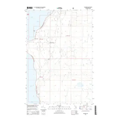
2014 Map of Maywood
USGS Topo · Published 2014About this map
Hiawatha National Forest dominates this coastal landscape along the eastern shores of Little Bay de Noc, where the interior is defined by a dense network of forest service roads and drainage systems. The small settlement of Maywood sits near the shoreline below Hunters Point, providing a primary point of reference for the region's limited development. A network of creeks, including Squaw Cr, Misery Cr, and Granskog Cr, cut through the forested terrain toward the bay. Genealogists and local historians can locate the Bay de Noc Cem and Lakewood Cem, which serve as permanent markers of the area's residents. Further inland, small water bodies like Schaawe Lake, Lake Sixteen, and Lake Little Sixteen dot the map, illustrating the hydrology of Delta County during this period of the early 21st century.
Find a feature on this map
19 named features on this map. Tap any name to fly to it.
Don’t see what you’re looking for? This feature index may not catch every label — zoom into the map to look around manually.
Map Details
Editions of this 2014 Maywood Map
This is the sole edition of this map. No revisions or reprints were ever made.
Other maps of this area

1932 · Gladstone NE
USGS Topo · 1:31,680

1932 · Rapid River NE
USGS Topo · 1:31,680

1932 · Gladstone SE
USGS Topo · 1:31,680

1932 · Rapid River NW
USGS Topo · 1:31,680

1932 · Rapid River SE
USGS Topo · 1:31,680

1932 · Rapid River SW
USGS Topo · 1:31,680

1954 · Escanaba
USGS Topo · 1:250,000

1957 · Escanaba
USGS Topo · 1:250,000

1958 · Escanaba
USGS Topo · 1:250,000

1958 · Gladstone
USGS Topo · 1:62,500