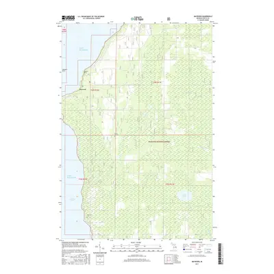
2017 Map of Maywood
USGS Topo · Published 2017About this map
Lake Michigan dominates the western shoreline of this Upper Peninsula landscape, where the waters of Little Bay de Noc meet the forested interior of the Hiawatha National Forest. The small settlement of Maywood sits near the northern coastal reach, flanked by prominent landforms like Saunders Point and Hunters Point. This 2017 survey illustrates the heavily timbered and wetland-rich environment characteristic of Delta County, with numerous small waterways such as Squaw Creek and Misery Cr draining into the bay.
Find a feature on this map
20 named features on this map. Tap any name to fly to it.
Don’t see what you’re looking for? This feature index may not catch every label — zoom into the map to look around manually.
Map Details
Editions of this 2017 Maywood Map
This is the sole edition of this map. No revisions or reprints were ever made.
Other maps of this area

1932 · Gladstone NE
USGS Topo · 1:31,680

1932 · Rapid River NE
USGS Topo · 1:31,680

1932 · Gladstone SE
USGS Topo · 1:31,680

1932 · Rapid River NW
USGS Topo · 1:31,680

1932 · Rapid River SE
USGS Topo · 1:31,680

1932 · Rapid River SW
USGS Topo · 1:31,680

1954 · Escanaba
USGS Topo · 1:250,000

1957 · Escanaba
USGS Topo · 1:250,000

1958 · Escanaba
USGS Topo · 1:250,000

1958 · Gladstone
USGS Topo · 1:62,500