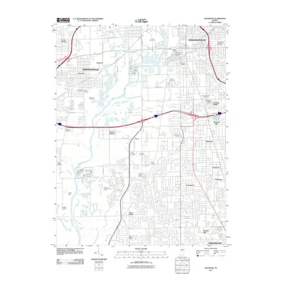
2011 Map of Maywood
USGS Topo · Published 2011About this map
Indianapolis urban development and industrial history converge along the southward course of the White River. The Union Stockyards stands as a significant landmark of the city's commercial past, while the Garfield Station Indianapolis Post Office anchors the neighborhood infrastructure. A dense network of memorial sites, including the Hebrew Cemetery, Holy Cross and Saint Joseph Cemetery, and Calvary Cemetery, provides a rich resource for genealogical research in Marion County.
Find a feature on this map
64 named features on this map. Tap any name to fly to it.
Don’t see what you’re looking for? This feature index may not catch every label — zoom into the map to look around manually.
Map Details
Editions of this 2011 Maywood Map
This is the sole edition of this map. No revisions or reprints were ever made.
Other maps of this area

1948 · Indianapolis East
USGS Topo · 1:24,000

1948 · Maywood
USGS Topo · 1:24,000

1948 · Beech Grove
USGS Topo · 1:24,000

1948 · Indianapolis West
USGS Topo · 1:24,000

1952 · Bargersville
USGS Topo · 1:24,000

1953 · Greenwood
USGS Topo · 1:24,000

1953 · Bridgeport
USGS Topo · 1:24,000

1953 · Clermont
USGS Topo · 1:24,000

1953 · Indianapolis
USGS Topo · 1:250,000

1955 · Mooresville East
USGS Topo · 1:24,000
Featured Places
- Indianapolis, IN
- Greenwood, IN
- Southport, Indianapolis
- Homecroft, Indianapolis
- Glenns Valley, Indianapolis