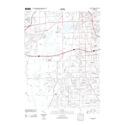
2013 Map of Maywood
USGS Topo · Published 2013About this map
The White River winds through the heart of this landscape south of downtown Indianapolis, defining the industrial and residential development of the early twenty-first century. Dense urban planning is evident in established neighborhoods like Mars Hill and Maywood, while the industrial footprint is anchored by the sprawling Union Stockyards and the Belmont Advanced Wastewater Treatment Facility. The map captures a transition toward suburban residential pockets such as Homecroft and Southport to the southeast, separated by the intricate drainage networks of Lick Cr and Little Buck Cr. Water management is a dominant theme, with numerous artificial channels like Hau-isen Ditch and Harmon Ditch crisscrossing the terrain to manage the floodplains. Recreational land use is prominent on the city's periphery, evidenced by the Buffer Park Golf Course and Southern Dunes Golf Course, reflecting the conversion of riverine areas into public green spaces.
Find a feature on this map
70 named features on this map. Tap any name to fly to it.
Don’t see what you’re looking for? This feature index may not catch every label — zoom into the map to look around manually.
Map Details
Editions of this 2013 Maywood Map
This is the sole edition of this map. No revisions or reprints were ever made.
Other maps of this area

1948 · Indianapolis East
USGS Topo · 1:24,000

1948 · Maywood
USGS Topo · 1:24,000

1948 · Beech Grove
USGS Topo · 1:24,000

1948 · Indianapolis West
USGS Topo · 1:24,000

1952 · Bargersville
USGS Topo · 1:24,000

1953 · Greenwood
USGS Topo · 1:24,000

1953 · Bridgeport
USGS Topo · 1:24,000

1953 · Clermont
USGS Topo · 1:24,000

1953 · Indianapolis
USGS Topo · 1:250,000

1955 · Mooresville East
USGS Topo · 1:24,000
Featured Places
- Indianapolis, IN
- Greenwood, IN
- Southport, Indianapolis
- Homecroft, Indianapolis
- Glenns Valley, Indianapolis