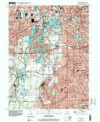
1998 Map of Maywood
USGS Topo · Published 2002About this map
The White River corridor south of Indianapolis serves as a primary geographic anchor for this late 20th-century survey, dividing the industrial and rail-heavy western sectors from the residential expansion in Perry Township. To the west, the footprint of Stout Field (Abandoned) and the Union Stockyards reflect the area's mid-century aviation and agricultural processing history. Significant educational and religious institutions are concentrated to the east, notably Indiana Central College and a high density of parochial schools including St Pauls Sch and St James Sch.
Find a feature on this map
72 named features on this map. Tap any name to fly to it.
Don’t see what you’re looking for? This feature index may not catch every label — zoom into the map to look around manually.
Map Details
Editions of this 1998 Maywood Map
This is the sole edition of this map. No revisions or reprints were ever made.
Other maps of this area

1948 · Indianapolis East
USGS Topo · 1:24,000

1948 · Maywood
USGS Topo · 1:24,000

1948 · Beech Grove
USGS Topo · 1:24,000

1948 · Indianapolis West
USGS Topo · 1:24,000

1952 · Bargersville
USGS Topo · 1:24,000

1953 · Greenwood
USGS Topo · 1:24,000

1953 · Bridgeport
USGS Topo · 1:24,000

1953 · Clermont
USGS Topo · 1:24,000

1953 · Indianapolis
USGS Topo · 1:250,000

1955 · Mooresville East
USGS Topo · 1:24,000
Featured Places
- Indianapolis, IN
- Greenwood, IN
- Southport, Indianapolis
- Homecroft, Indianapolis
- Drexel Gardens, Indianapolis