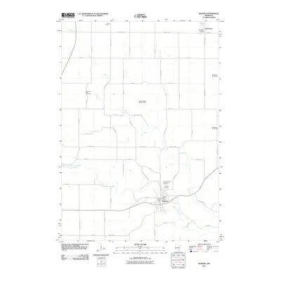
2010 Map of Mazeppa
USGS Topo · Published 2010About this map
The North Fork Zumbro River flows through the heart of Mazeppa, where the local water management is defined by the Zumbro River Dam. This 2010 survey illustrates a landscape primarily shaped by agriculture and water control, featuring several drainage structures like the Merlyn Hadler Detention Dam. To the north, the small community of Bellechester sits at the intersection of several county highways. Genealogists will find a significant concentration of local burial grounds, including Grace Cemetery, Saints Peter and Paul Catholic Cemetery, and Saint Mary's Catholic Cemetery, which preserve the names and locations of early regional congregations. The map also records the location of the Mazeppa Post Office and the winding course of Trout Brook as it feeds into the Zumbro River system.
Find a feature on this map
52 named features on this map. Tap any name to fly to it.
Don’t see what you’re looking for? This feature index may not catch every label — zoom into the map to look around manually.
Map Details
Editions of this 2010 Mazeppa Map
This is the sole edition of this map. No revisions or reprints were ever made.
Other maps of this area

1935 · Rochester
USGS Topo · 1:48,000

1939 · Rochester
USGS Topo · 1:62,500

1951 · Lake City
USGS Topo · 1:62,500

1953 · Saint Paul
USGS Topo · 1:250,000

1959 · Saint Paul
USGS Topo · 1:250,000

1965 · Oronoco
USGS Topo · 1:24,000

1965 · Pine Island
USGS Topo · 1:24,000

1968 · Goodhue East
USGS Topo · 1:24,000

1968 · Zumbrota
USGS Topo · 1:24,000

1968 · Mazeppa
USGS Topo · 1:24,000