
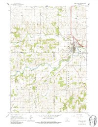
1965 Map of Pine Island
USGS Topo · Published 1967About this map
The Chicago Great Western railroad corridor cuts through the landscape near Pine Island, serving as a primary transportation artery through this corner of Goodhue County in the mid-1960s. The town's infrastructure is detailed with markers for a Sewage Disposal plant and a local Townhall, while the surrounding rural landscape is defined by the winding course of the Middle Fork Zumbro River and its many tributaries, including Harkcom Creek and North Branch. Much of the eastern terrain is protected under the Richard J Dorer Memorial Hardwood State Forest, showing the blend of conservation and agriculture. For genealogists, the map provides precise locations for several burial grounds, including County Line Cem, St Michael Cem, and Milton Cem. Industrial activity is noted through scattered Quarries and a Quarry near the forest boundary, reflecting the local extraction economy alongside the river.
Find a feature on this map
25 named features on this map. Tap any name to fly to it.
Don’t see what you’re looking for? This feature index may not catch every label — zoom into the map to look around manually.
Map Details
Editions of this 1965 Pine Island Map
2 editions found
Other maps of this area

1953 · Saint Paul
USGS Topo · 1:250,000

1959 · Saint Paul
USGS Topo · 1:250,000

1965 · Dodge Center
USGS Topo · 1:24,000

1965 · Concord
USGS Topo · 1:24,000

1965 · Oronoco
USGS Topo · 1:24,000

1965 · Byron
USGS Topo · 1:24,000

1966 · Douglas
USGS Topo · 1:24,000

1968 · Zumbrota
USGS Topo · 1:24,000

1968 · Mazeppa
USGS Topo · 1:24,000

1968 · Wanamingo
USGS Topo · 1:24,000