
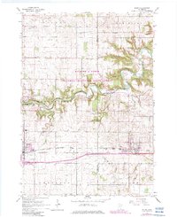
1965 Map of Byron
USGS Topo · Published 1967About this map
The Chicago and North Western railroad corridor anchors the southern half of this mid-1960s landscape, connecting the growing communities of Kasson and Byron. The era's land use is clearly visible, with agricultural field lines and properties marked by red dashed lines between the townships of Mantorville, Kalmar, and New Haven. These structured farmsteads contrast with the serpentine green corridor of the Minnesota Memorial Hardwood State Forest, which follows the winding course of the Middle Fork Zumbro River.
Find a feature on this map
29 named features on this map. Tap any name to fly to it.
Don’t see what you’re looking for? This feature index may not catch every label — zoom into the map to look around manually.
Map Details
Editions of this 1965 Byron Map
2 editions found
Other maps of this area

1953 · Saint Paul
USGS Topo · 1:250,000

1954 · Mason City
USGS Topo · 1:250,000

1955 · High Forest
USGS Topo · 1:62,500

1957 · Mason City
USGS Topo · 1:250,000

1958 · Mason City
USGS Topo · 1:250,000

1959 · Saint Paul
USGS Topo · 1:250,000

1965 · Dodge Center
USGS Topo · 1:24,000

1965 · Concord
USGS Topo · 1:24,000

1965 · Oronoco
USGS Topo · 1:24,000

1965 · Pine Island
USGS Topo · 1:24,000