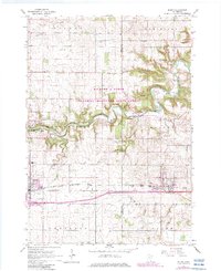
1965 Map of Byron
USGS Topo · Published 1983About this map
The South Branch Middle Fork Zumbro River carves a deep, winding path through the center of this 1965 survey, defining the rugged geography of the Richard J Dorer Memorial Hardwood State Forest. This timbered corridor stands in sharp contrast to the surrounding agricultural uplands of Milton and New Haven. The transition from river valley to flat prairie is marked by numerous springs and small tributaries like Plum Creek and Harkcom Creek.
Find a feature on this map
30 named features on this map. Tap any name to fly to it.
Don’t see what you’re looking for? This feature index may not catch every label — zoom into the map to look around manually.
Map Details
Editions of this 1965 Byron Map
2 editions found
Other maps of this area

1953 · Saint Paul
USGS Topo · 1:250,000

1954 · Mason City
USGS Topo · 1:250,000

1955 · High Forest
USGS Topo · 1:62,500

1957 · Mason City
USGS Topo · 1:250,000

1958 · Mason City
USGS Topo · 1:250,000

1959 · Saint Paul
USGS Topo · 1:250,000

1965 · Dodge Center
USGS Topo · 1:24,000

1965 · Concord
USGS Topo · 1:24,000

1965 · Oronoco
USGS Topo · 1:24,000

1965 · Byron
USGS Topo · 1:24,000