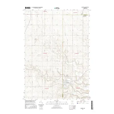
2016 Map of Mazeppa
USGS Topo · Published 2016About this map
Mazeppa and Bellechester anchor this 2016 survey of the undulating borderland between Goodhue and Wabasha Counties. The landscape is defined by the winding course of the N Fork Zumbro River, which feeds into the Zumbro River Reservoir near the heart of the settlement. The map provides significant detail for genealogists and local historians, documenting the exact locations of numerous burial grounds including Saints Peter and Paul Catholic Cem and Zumbrota East Cem. Agricultural land use is evident throughout, with the terrain falling away into Bear Valley in the northeast. Small-scale drainage features like Trout Brook and numerous unnamed tributaries have carved a complex network of ridges and hollows, dictating the placement of the rural road network and the boundaries of the Merlin Hadler property.
Find a feature on this map
66 named features on this map. Tap any name to fly to it.
Don’t see what you’re looking for? This feature index may not catch every label — zoom into the map to look around manually.
Map Details
Editions of this 2016 Mazeppa Map
This is the sole edition of this map. No revisions or reprints were ever made.
Other maps of this area

1935 · Rochester
USGS Topo · 1:48,000

1939 · Rochester
USGS Topo · 1:62,500

1951 · Lake City
USGS Topo · 1:62,500

1953 · Saint Paul
USGS Topo · 1:250,000

1959 · Saint Paul
USGS Topo · 1:250,000

1965 · Oronoco
USGS Topo · 1:24,000

1965 · Pine Island
USGS Topo · 1:24,000

1968 · Goodhue East
USGS Topo · 1:24,000

1968 · Zumbrota
USGS Topo · 1:24,000

1968 · Mazeppa
USGS Topo · 1:24,000