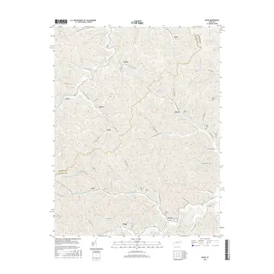
2016 Map of Mazie
USGS Topo · Published 2016About this map
Mazie and Skaggs sit at the center of this 2016 survey, where the Left Fork Blaine Cr flows through the deep drainage basins of eastern Kentucky. The landscape is defined by its intricate network of family-named hollows and cemeteries, reflecting a long-standing genealogical footprint in Elliott and Lawrence counties. Communities such as Martha, Blevins, and Sarah are connected by narrow winding routes like Coal Mine Rd and Hurricane Creek Rd, tracing the paths of the numerous branches and forks that feed into the Little Fork Little Sandy River. Local history is preserved in the distribution of family burial grounds, including the Ran Boggs Cem, Bishop Cem, and Hay Cem, while the inclusion of the Martha Fish Pond provides a specific point of local reference in this rural landscape.
Find a feature on this map
90 named features on this map. Tap any name to fly to it.
Don’t see what you’re looking for? This feature index may not catch every label — zoom into the map to look around manually.
Map Details
Editions of this 2016 Mazie Map
This is the sole edition of this map. No revisions or reprints were ever made.
Other maps of this area

1886 · Prestonsburg
USGS Topo · 1:125,000

1889 · Salyersville
USGS Topo · 1:125,000

1891 · Salyersville
USGS Topo · 1:125,000

1892 · Prestonsburg
USGS Topo · 1:125,000

1899 · Salyersville
USGS Topo · 1:125,000

1903 · Kenova
USGS Topo · 1:125,000

1904 · Kenova
USGS Topo · 1:125,000

1915 · Paintsville
USGS Topo · 1:48,000

1917 · Paintsville
USGS Topo · 1:62,500

1950 · Bruin
USGS Topo · 1:24,000