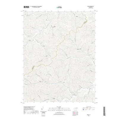
2019 Map of Mazie
USGS Topo · Published 2019About this map
The complex ridge-and-valley terrain of the Elliott and Lawrence County line defines this area of eastern Kentucky, where small communities follow the winding paths of the numerous forks and branches. Significant family-named landmarks are scattered throughout the landscape, including the Jason Boggs, Dave Boggs, and Ran Boggs cemeteries near Blevins. The settlement pattern is strictly dictated by the hydrology of the Blaine Creek watershed, with hamlets like Mazie, Martha, and Skaggs established at narrow creek junctions.
Find a feature on this map
92 named features on this map. Tap any name to fly to it.
Don’t see what you’re looking for? This feature index may not catch every label — zoom into the map to look around manually.
Map Details
Editions of this 2019 Mazie Map
This is the sole edition of this map. No revisions or reprints were ever made.
Other maps of this area

1886 · Prestonsburg
USGS Topo · 1:125,000

1889 · Salyersville
USGS Topo · 1:125,000

1891 · Salyersville
USGS Topo · 1:125,000

1892 · Prestonsburg
USGS Topo · 1:125,000

1899 · Salyersville
USGS Topo · 1:125,000

1903 · Kenova
USGS Topo · 1:125,000

1904 · Kenova
USGS Topo · 1:125,000

1915 · Paintsville
USGS Topo · 1:48,000

1917 · Paintsville
USGS Topo · 1:62,500

1950 · Bruin
USGS Topo · 1:24,000