
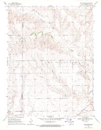
1969 Map of Mc Allaster NE
USGS Topo · Published 1971About this map
The South Fork Solomon River and South Fork Saline River carve through the high plains of Western Kansas in this late 1960s topographic study. The landscape is defined by the drainage patterns between these two waterways, showing the transition from the Kingery uplands down toward the river breaks. The map documents the rural settlement of Brownville and the nearby Brownville Cem, providing a precise record for genealogists and local historians of the era. The presence of a Landing Strip and a Radio Tower reflect mid-century infrastructure developments in this agricultural region. Straddling the Thomas Co Logan Co boundary, the sheet offers a clear view of the section lines and rural road networks that shaped the townships of Mc Allaster and Winona before the turn of the decade.
Find a feature on this map
11 named features on this map. Tap any name to fly to it.
Don’t see what you’re looking for? This feature index may not catch every label — zoom into the map to look around manually.
Map Details
Editions of this 1969 Mc Allaster NE Map
This is the sole edition of this map. No revisions or reprints were ever made.
Other maps of this area

1943 · Colby
USGS Topo · 1:62,500

1954 · Goodland
USGS Topo · 1:250,000

1956 · Goodland
USGS Topo · 1:250,000

1957 · Goodland
USGS Topo · 1:250,000

1966 · Brewster
USGS Topo · 1:24,000

1966 · Brewster SE
USGS Topo · 1:24,000

1967 · Colby SW
USGS Topo · 1:24,000

1969 · Mc Allaster NW
USGS Topo · 1:24,000

1969 · Mc Allaster SE
USGS Topo · 1:24,000
1969 · Mc Allaster
USGS Topo · 1:24,000